Related Articles

Car navigation systems have completely changed the way we travel. A few decades ago, drivers relied on paper maps, road signs, and asking strangers for directions. Today, modern vehicles can guide drivers turn by turn, suggest faster routes, avoid traffic, and even locate nearby fuel stations or restaurants. As someone who enjoys learning about automotive technology, I believe car navigation systems are one of the most practical innovations in modern vehicles.
In this article, I will explain how car navigation systems work, the technology behind them, their key components, and why they have become an essential feature in modern cars.
What Is a Car Navigation System?
A car navigation system is an electronic system designed to help drivers find routes and reach destinations efficiently. It combines satellite technology, digital maps, sensors, and software to determine the vehicle’s location and provide accurate directions.
Modern navigation systems are available in different forms. Some are built directly into the vehicle’s infotainment system, while others work through smartphones using applications such as Google Maps, Apple Maps, or Waze.
The main purpose of a navigation system is simple. It helps drivers travel from one location to another using the best possible route.
The Basic Working Principle of Car Navigation Systems
To understand how car navigation systems work, it is important to know that they rely on three main elements:
- GPS satellites
- Digital maps
- Navigation software
These three components work together continuously to provide accurate location information and route guidance.
The system first determines the vehicle’s exact position using satellites. Then it compares that location with stored map data. Finally, intelligent software calculates the best route and displays instructions on the screen.
This process happens within seconds and updates continuously while driving.
Understanding GPS Technology
GPS stands for Global Positioning System. It is one of the most important technologies behind car navigation systems.
GPS is a network of satellites orbiting the Earth. These satellites send signals to GPS receivers installed in vehicles or smartphones.
A navigation system receives signals from multiple satellites at the same time. By measuring the distance from each satellite, the system calculates the exact location of the vehicle.
For accurate positioning, at least four satellites are usually needed.
This process is known as trilateration. It allows the system to determine:
• Latitude
• Longitude
• Altitude
• Vehicle movement
Modern GPS systems are highly accurate and can often locate a vehicle within a few meters.
The Role of Digital Maps
GPS alone cannot guide drivers. It only provides location information. Digital maps are equally important because they contain road details.
Digital maps include:
• Roads and highways
• Streets and intersections
• Traffic signs
• Speed limits
• Points of interest
• Fuel stations
• Restaurants
• Parking areas
The navigation system compares the vehicle’s GPS location with the map database. This allows it to show where the car is and suggest the best route.
Map updates are essential because roads frequently change. New highways, bridges, and construction projects require regular updates to maintain accuracy.
How Route Calculation Works
When a driver enters a destination, the navigation system starts calculating possible routes.
The software analyzes several factors, including:
• Distance
• Speed limits
• Traffic conditions
• Road types
• Tolls
• Estimated travel time
The system then selects the most efficient route.
Advanced navigation systems can provide multiple options, such as:
• Fastest route
• Shortest route
• Toll free route
• Scenic route
This flexibility helps drivers choose routes according to their preferences.
Real Time Traffic Information
One of the most useful features of modern car navigation systems is live traffic updates.
Navigation systems collect traffic data from various sources, including:
• Traffic cameras
• Government traffic services
• Mobile devices
• Connected vehicles
This information helps detect:
• Traffic jams
• Road closures
• Accidents
• Construction zones
If traffic conditions change, the system automatically recalculates the route.
In my opinion, this feature saves time, reduces stress, and improves driving efficiency.
Sensors Used in Navigation Systems
Modern car navigation systems use more than GPS. Additional sensors improve accuracy, especially in areas where satellite signals are weak.
Common sensors include:
Speed Sensors
These measure wheel speed and help estimate vehicle movement.
Gyroscopes
Gyroscopes detect changes in direction and rotation.
Accelerometers
Accelerometers measure acceleration and deceleration.
Compass Sensors
Electronic compasses determine vehicle orientation.
These sensors work together to maintain accurate positioning, even in tunnels, parking garages, or urban areas with tall buildings.
Voice Guidance Technology
Voice guidance is another important part of modern navigation systems.
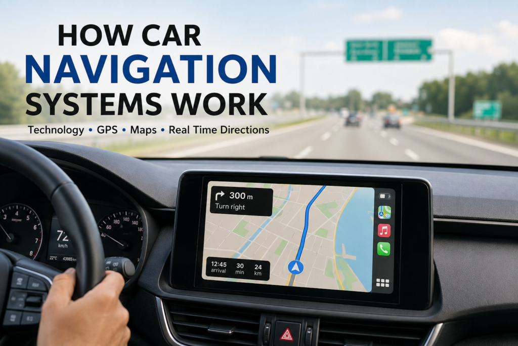
Instead of constantly looking at the screen, drivers receive spoken instructions such as:
“Turn right in 300 meters.”
This feature improves safety because drivers can focus on the road.
Advanced systems now offer natural voice assistants that can understand commands like:
• Find nearby restaurants
• Navigate home
• Locate the nearest fuel station
Voice control makes navigation more convenient and reduces distractions.
Integration With Smartphones
Many modern vehicles support smartphone integration through technologies such as:
• Apple CarPlay
• Android Auto
These systems allow drivers to access navigation apps directly from the car’s display.
Benefits include:
• Updated maps
• Real time traffic
• Voice commands
• Easy destination search
I think smartphone integration has made navigation systems more affordable and practical for many drivers.
Offline Navigation Systems
Not all navigation systems require internet access.
Built in navigation systems often store maps directly in the vehicle.
Advantages of offline navigation include:
• Works without mobile data
• Reliable in remote areas
• No signal dependency
This is particularly useful during long trips through rural regions where internet coverage is limited.
Connected Car Navigation Systems
Modern vehicles are becoming smarter through internet connectivity.
Connected navigation systems can provide:
• Weather information
• Fuel prices
• Parking availability
• Traffic updates
• Charging station locations for electric vehicles
This creates a more personalized driving experience.
As automotive technology continues to evolve, connected systems are becoming increasingly important.
Artificial Intelligence in Navigation Systems
Artificial intelligence is improving navigation technology in many ways.
AI can learn driver habits and preferences.
For example, the system may recognize:
• Frequently visited locations
• Preferred routes
• Driving patterns
AI can also predict traffic conditions and suggest better travel times.
This makes navigation more intelligent and efficient.
Benefits of Car Navigation Systems
There are many advantages to using modern navigation systems.
Saves Time
Drivers can choose faster routes and avoid congestion.
Reduces Stress
No need to worry about getting lost.
Improves Fuel Efficiency
Shorter routes can reduce fuel consumption.
Enhances Safety
Voice guidance allows drivers to focus on the road.
Better Trip Planning
Drivers can find services and facilities along the route.
These benefits explain why navigation systems are now standard in many vehicles.
Challenges and Limitations
Although navigation systems are highly useful, they are not perfect.
Common challenges include:
• Weak GPS signals
• Outdated maps
• Incorrect traffic information
• Technical errors
Drivers should always remain alert and use common sense while following directions.
Technology is helpful, but safe driving should always come first.
The Future of Car Navigation Systems
The future of navigation technology looks exciting.
Upcoming innovations may include:
• Augmented reality navigation
• AI powered route planning
• Vehicle to vehicle communication
• Self driving integration
• More accurate real time updates
Some systems already display navigation directions directly on the windshield using head up display technology.
These advancements will make driving safer, easier, and more efficient.
Final Thoughts
Car navigation systems have become an essential part of modern driving. They combine GPS technology, digital maps, sensors, and intelligent software to guide drivers accurately and efficiently.
From real time traffic updates to voice guidance and AI powered features, navigation systems continue to improve every year.
In my view, the best thing about modern navigation technology is that it not only helps us reach our destination but also makes the journey more comfortable, safer, and less stressful.
As vehicles become smarter and more connected, car navigation systems will play an even bigger role in the future of transportation.